
Wêne:Isla Perejil NWW.png
Mezinahiya vê pêşdîtinê: 800 × 548 pîksel. Resolusyonên din: 320 × 219 pîksel | 640 × 439 pîksel | 1024 × 702 pîksel.
Dosyeya orjînal (1024 × 702 pixel, mezinbûnê data: 878 KB, MIME-typ: image/png)
| Ev pel ji Wikimedia Commonsê ye. Agahdariya li ser rûpela danasîna pelê li jêr tê nîşandan. |
Danasîn
| Danasîn |
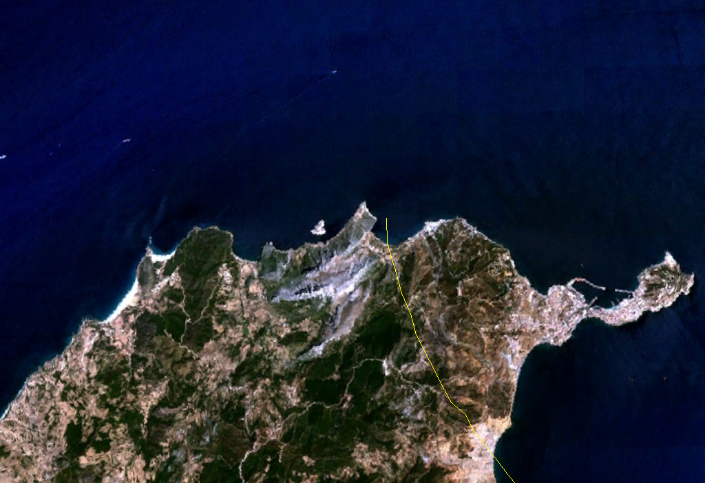
English: Isla Perejil in North Africa. Satellite picture. |
| Dîrok | 18 tebax 2005 (upload date) |
| Çavkanî | Satellite imagery taken from NASA World Wind software (by screenshot) |
| Xwedî | NASA |
Lîsans
| This image is in the public domain because it is a screenshot from NASA’s globe software World Wind using a public domain layer, such as Blue Marble, MODIS, Landsat, SRTM, USGS or GLOBE.
|
 |
| Annotations | This image is annotated: View the annotations at Commons |
Dîroka daneyê
Ji bo dîtina guhartoya wê demê bişkoka dîrokê bitikîne.
| Dîrok/Katjimêr | Wêneyê biçûk | Mezinahî | Bikarhêner | Şirove | |
|---|---|---|---|---|---|
| niha | 14:44, 18 tebax 2005 | | 1024 x 702 (878 KB) | JMPerez~commonswiki | Screenshot taken from NASA World Wind of the Isla Perejil. {{PD-USGov-NASA}} Category:Islands Category:Satellite photos |
| 14:39, 18 tebax 2005 |  | 1024 x 702 (884 KB) | JMPerez~commonswiki | Screenshot taken from NASA World Wind of the Isla Perejil. {{PD-USGov-NASA}} Category:Islands Category:Satellite photos |
Bikaranîna pelê
Ev rûpelên li jêr vê dosyeyê bi kar tînin:
Bikaranîna gerdûnî ya pelê
Ev wîkiyên di rêzê de vê pelê bi kar tînin:
- Bikaranîna di an.wikipedia.org de
- Bikaranîna di ar.wikipedia.org de
- Bikaranîna di de.wikipedia.org de
- Bikaranîna di eo.wikipedia.org de
- Bikaranîna di es.wikipedia.org de
- Bikaranîna di fi.wikipedia.org de
- Bikaranîna di he.wikipedia.org de
- Bikaranîna di hu.wikipedia.org de
- Bikaranîna di id.wikipedia.org de
- Bikaranîna di it.wikipedia.org de
- Bikaranîna di nn.wikipedia.org de