
Wêne:Location Malay Archipelago.png
Versyonekî jê mezintir tune.
Location_Malay_Archipelago.png (640 × 326 pixel, mezinbûnê data: 17 KB, MIME-typ: image/png)
| Ev pel ji Wikimedia Commonsê ye. Agahdariya li ser rûpela danasîna pelê li jêr tê nîşandan. |
Danasîn
| Danasîn |
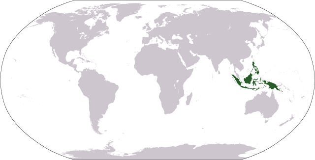
World map depicting the Malay Archipelago; includes islands per en:Oxford English Dictionary and Encyclopaedia Britannica Map adapted from PDF world map at en:CIA World Fact Book |
| Dîrok | 18 îlon 2006 (original upload date) |
| Çavkanî | Galelio |
| Xwedî | Galelio |
Lîsans
| I, the copyright holder of this work, release this work into the public domain. This applies worldwide. In some countries this may not be legally possible; if so: I grant anyone the right to use this work for any purpose, without any conditions, unless such conditions are required by law. |
Dîroka daneyê
Ji bo dîtina guhartoya wê demê bişkoka dîrokê bitikîne.
| Dîrok/Katjimêr | Wêneyê biçûk | Mezinahî | Bikarhêner | Şirove | |
|---|---|---|---|---|---|
| niha | 02:48, 18 îlon 2006 | | 640 x 326 (17 KB) | Cogito ergo sumo~commonswiki | World map: Malay Archipelago (location) |
Bikaranîna pelê
Ev rûpelên li jêr vê dosyeyê bi kar tînin:
Bikaranîna gerdûnî ya pelê
Ev wîkiyên di rêzê de vê pelê bi kar tînin:
- Bikaranîna di ace.wikipedia.org de
- Bikaranîna di af.wikipedia.org de
- Bikaranîna di bcl.wikipedia.org de
- Bikaranîna di bg.wikipedia.org de
- Bikaranîna di bn.wikipedia.org de
- Bikaranîna di bs.wikipedia.org de
- Bikaranîna di cs.wikipedia.org de
- Bikaranîna di cy.wikipedia.org de
- Bikaranîna di en.wikipedia.org de
- Bikaranîna di en.wikivoyage.org de
- Bikaranîna di eo.wikipedia.org de
- Bikaranîna di et.wikipedia.org de
- Bikaranîna di fa.wikipedia.org de
- Bikaranîna di fi.wikipedia.org de
- Bikaranîna di hr.wikipedia.org de
- Bikaranîna di is.wikipedia.org de
- Bikaranîna di it.wikipedia.org de
- Bikaranîna di ja.wikipedia.org de
- Bikaranîna di ka.wikipedia.org de
- Bikaranîna di km.wikipedia.org de
- Bikaranîna di ko.wikipedia.org de
- Bikaranîna di lt.wikipedia.org de
- Bikaranîna di mg.wikipedia.org de
- Bikaranîna di mk.wikipedia.org de
- Bikaranîna di mr.wikipedia.org de
- Bikaranîna di ms.wikipedia.org de
- Bikaranîna di pl.wikipedia.org de
- Bikaranîna di pt.wikipedia.org de
- Bikaranîna di sh.wikipedia.org de
- Bikaranîna di simple.wikipedia.org de
- Bikaranîna di sk.wikipedia.org de
- Bikaranîna di sl.wikipedia.org de
- Bikaranîna di sr.wikipedia.org de
- Bikaranîna di stq.wikipedia.org de
- Bikaranîna di sw.wikipedia.org de
- Bikaranîna di ta.wikipedia.org de
- Bikaranîna di th.wikipedia.org de
- Bikaranîna di tl.wikipedia.org de
- Bikaranîna di uz.wikipedia.org de
- Bikaranîna di war.wikipedia.org de
- Bikaranîna di zh-yue.wikipedia.org de