
Wêne:青ヶ島 2.jpg

Mezinahiya vê pêşdîtinê: 520 × 600 pîksel. Resolusyonên din: 208 × 240 pîksel | 416 × 480 pîksel | 666 × 768 pîksel | 887 × 1024 pîksel | 2438 × 2813 pîksel.
Dosyeya orjînal (2438 × 2813 pixel, mezinbûnê data: 2,72 MB, MIME-typ: image/jpeg)
| Ev pel ji Wikimedia Commonsê ye. Agahdariya li ser rûpela danasîna pelê li jêr tê nîşandan. |
Danasîn
| Danasîn |
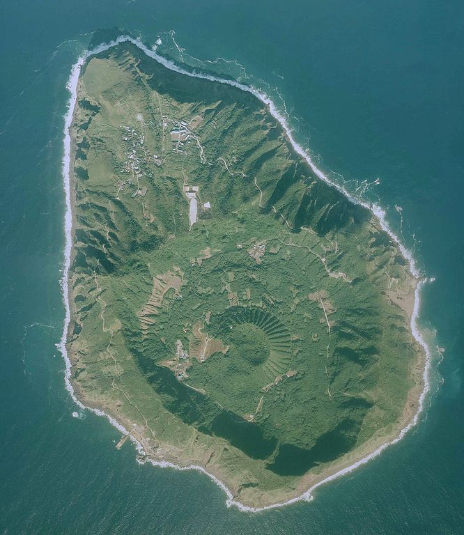
日本語: 青ヶ島の航空写真。国土地理院の地図・空中写真閲覧サービスより
|
| Dîrok | |
| Çavkanî | http://mapps.gsi.go.jp/maplibSearch.do#1 |
| Xwedî | 国土地理院 |
Lîsans

|
The copyright holder of this file, Ministry of Land, Infrastructure, Transport and Tourism, allows anyone to use it for any purpose, provided that the copyright holder is properly attributed. Redistribution, derivative work, commercial use, and all other use is permitted. |
Lê bar kirin:
National Land Image Information (Color Aerial Photographs), created by Ministry of Land, Infrastructure, Transport and Tourism, distributed by Geospatial Information Authority of Japan
|

Dîroka daneyê
Ji bo dîtina guhartoya wê demê bişkoka dîrokê bitikîne.
| Dîrok/Katjimêr | Wêneyê biçûk | Mezinahî | Bikarhêner | Şirove | |
|---|---|---|---|---|---|
| niha | 08:18, 28 gulan 2017 | | 2438 x 2813 (2,72 MB) | Nux-vomica 1007 | User created page with UploadWizard |
Bikaranîna pelê
Ev rûpelên li jêr vê dosyeyê bi kar tînin:
Bikaranîna gerdûnî ya pelê
Ev wîkiyên di rêzê de vê pelê bi kar tînin:
- Bikaranîna di en.wikipedia.org de
- Bikaranîna di fr.wikipedia.org de
- Bikaranîna di ja.wikivoyage.org de
- Bikaranîna di uk.wikipedia.org de