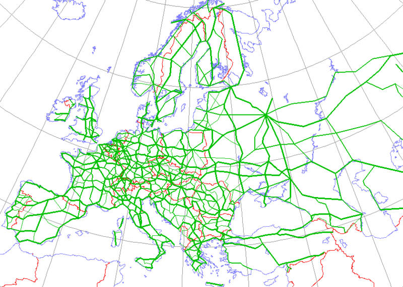
Wêne:International E Road Network green.png

Mezinahiya vê pêşdîtinê: 800 × 571 pîksel. Resolusyonên din: 320 × 229 pîksel | 640 × 457 pîksel.
Dosyeya orjînal (840 × 600 pixel, mezinbûnê data: 38 KB, MIME-typ: image/png)
Dîroka daneyê
Ji bo dîtina guhartoya wê demê bişkoka dîrokê bitikîne.
| Dîrok/Katjimêr | Wêneyê biçûk | Mezinahî | Bikarhêner | Şirove | |
|---|---|---|---|---|---|
| niha | 16:09, 13 gulan 2008 |  | 840 x 600 (38 KB) | Jklamo | Albania update |
| 12:07, 22 kanûna pêşîn 2007 |  | 840 x 600 (39 KB) | BIL | == Description == {{Information |Description=Map generated using coastline/boundary data from World Data Bank, and locations from www.world-gazetteer.com. Straight lines connect control cities, no attempt to follow the real road. Roads color has been chan | |
| 20:03, 7 çiriya pêşîn 2007 |  | 840 x 600 (33 KB) | The RedBurn | All e-roads in green. | |
| 19:55, 7 çiriya pêşîn 2007 |  | 840 x 600 (34 KB) | The RedBurn | {{Information |Description=Map generated using coastline/boundary data from World Data Bank, and locations from www.world-gazetteer.com. Straight lines connect control cities, no attempt to follow the real road. Roads color has been changed to green. |Sou |
Bikaranîna pelê
Ev 10 rûpel li jêr vê dosyeyê bi kar tînin:
Bikaranîna gerdûnî ya pelê
Ev wîkiyên di rêzê de vê pelê bi kar tînin:
- Bikaranîna di ar.wikipedia.org de
- Bikaranîna di be.wikipedia.org de
- Bikaranîna di bg.wikipedia.org de
- Европейски път
- Европейски път Е79
- Европейски път Е70
- Европейски път Е80
- Европейски път Е67
- Европейски път Е85
- Европейски път Е851
- Европейски път Е671
- Шаблон:Европейска пътна мрежа
- Европейски път Е81
- Европейски път Е804
- Европейски път Е763
- Европейски път Е762
- Европейски път Е87
- Европейски път Е772
- Европейски път Е83
- Европейски път Е871
- Европейски път Е75
- Европейски път Е773
- Европейски път Е11
- Европейски път Е51
- Европейски път Е761
- Европейски път Е17
- Европейски път Е76
- Европейски път Е82
- Европейски път Е84
- Европейски път Е86
- Европейски път E01
- Европейски път E03
- Европейски път E04
- Европейски път E05
- Европейски път E06
- Европейски път E07
- Европейски път E08
- Европейски път E09
- Европейски път E10
- Европейски път E12
- Европейски път E13
- Европейски път E14
Zêdetir bikaranîna global a vê pelê bibîne.

