
Wêne:Jackson Glacier terminus.jpg
Mezinahiya vê pêşdîtinê: 800 × 540 pîksel. Resolusyonên din: 320 × 216 pîksel | 640 × 432 pîksel | 900 × 608 pîksel.
Dosyeya orjînal (900 × 608 pixel, mezinbûnê data: 131 KB, MIME-typ: image/jpeg)
| Ev pel ji Wikimedia Commonsê ye. Agahdariya li ser rûpela danasîna pelê li jêr tê nîşandan. |
Danasîn
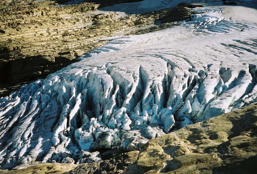
| Danasîn | Image of the terminal end of Jackson Glacier in Glacier National Park (U.S.) |
| Çavkanî | United States Geological Survey...from the following link [1], enlarged at [2] |
| Xwedî | USGS |
![[2]](https://www.nrmsc.usgs.gov/images/gcc/Jackson_terminus.jpg)
| Şûnda kamerayê | | Ev wêne û yên din li ser OpenStreetMap |
|---|
Lîsans
This image is in the public domain in the United States because it only contains materials that originally came from the United States Geological Survey, an agency of the United States Department of the Interior. For more information, see the official USGS copyright policy.
|
Dîroka daneyê
Ji bo dîtina guhartoya wê demê bişkoka dîrokê bitikîne.
| Dîrok/Katjimêr | Wêneyê biçûk | Mezinahî | Bikarhêner | Şirove | |
|---|---|---|---|---|---|
| niha | 00:16, 20 kanûna paşîn 2008 | | 900 x 608 (131 KB) | MONGO | {{Information |Description=Image of the terminal end of Jackson Glacier in Glacier National Park (U.S.) |Source=United States Geological Survey...from the following link [http://www.nrmsc.usgs.g |
Bikaranîna pelê
Ev rûpelên li jêr vê dosyeyê bi kar tînin:
Bikaranîna gerdûnî ya pelê
Ev wîkiyên di rêzê de vê pelê bi kar tînin:
- Bikaranîna di as.wikipedia.org de
- Bikaranîna di ceb.wikipedia.org de
- Bikaranîna di cy.wikipedia.org de
- Bikaranîna di el.wikipedia.org de
- Bikaranîna di en.wikipedia.org de
- Bikaranîna di en.wikiversity.org de
- Bikaranîna di eo.wikipedia.org de
- Bikaranîna di fa.wikipedia.org de
- Bikaranîna di fr.wikipedia.org de
- Bikaranîna di fy.wikipedia.org de
- Bikaranîna di hr.wikipedia.org de
- Bikaranîna di hy.wikipedia.org de
- Bikaranîna di nl.wikipedia.org de
- Bikaranîna di sr.wikipedia.org de
- Bikaranîna di ur.wikipedia.org de
- Bikaranîna di www.wikidata.org de