
Wêne:MasjidNabawi.jpg

Mezinahiya vê pêşdîtinê: 800 × 600 pîksel. Resolusyonên din: 320 × 240 pîksel | 640 × 480 pîksel | 1024 × 768 pîksel | 1280 × 960 pîksel | 2560 × 1920 pîksel | 4320 × 3240 pîksel.
Dosyeya orjînal (4320 × 3240 pixel, mezinbûnê data: 2,6 MB, MIME-typ: image/jpeg)
| Ev pel ji Wikimedia Commonsê ye. Agahdariya li ser rûpela danasîna pelê li jêr tê nîşandan. |
Danasîn
| Danasîn |
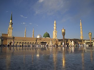
English: The Prophet's Mosque. |
| Dîrok | |
| Çavkanî | Min çêkir |
| Xwedî | Wurzelgnohm |
| Şûnda kamerayê | | Ev wêne û yên din li ser OpenStreetMap |
|---|
Lîsans
I, the copyright holder of this work, hereby publish it under the following license:
| This file is made available under the Creative Commons CC0 1.0 Universal Public Domain Dedication. | |
| The person who associated a work with this deed has dedicated the work to the public domain by waiving all of their rights to the work worldwide under copyright law, including all related and neighboring rights, to the extent allowed by law. You can copy, modify, distribute and perform the work, even for commercial purposes, all without asking permission.
|
Dîroka daneyê
Ji bo dîtina guhartoya wê demê bişkoka dîrokê bitikîne.
| Dîrok/Katjimêr | Wêneyê biçûk | Mezinahî | Bikarhêner | Şirove | |
|---|---|---|---|---|---|
| niha | 19:14, 4 adar 2012 | | 4320 x 3240 (2,6 MB) | Wurzelgnohm | full resolution |
| 14:43, 4 adar 2012 |  | 1680 x 1050 (357 KB) | Wurzelgnohm | {{Information |Description ={{en|1=The Prophet's Mosque.}} |Source ={{own}} |Author =Wurzelgnohm |Date = |Permission = |other_versions = }} |
Bikaranîna pelê
Ev rûpelên li jêr vê dosyeyê bi kar tînin:
Bikaranîna gerdûnî ya pelê
Ev wîkiyên di rêzê de vê pelê bi kar tînin:
- Bikaranîna di ar.wikipedia.org de
- الحجاز
- البقيع
- المسجد النبوي
- جامع براثا
- المسجد الحرام
- غار ثور
- جبل عرفة
- العتبة العسكرية
- مسجد قباء
- مسجد العنبرية
- الصفا والمروة
- بوابة:الإسلام/مقالة مختارة
- قائمة الأماكن المقدسة عند الشيعة
- منى
- المدائن
- العتبة الكاظمية
- جبل أحد
- مسجد الكوفة
- مسجد الحنانة
- مسجد جمكران
- العتبة الفاطمية
- مسجد ذي الحليفة
- مسجد القبلتين
- المسجد الأقصى
- مسجد الإجابة (المدينة المنورة)
- مسجد السهلة
- العتبة العلوية
- العتبة العباسية
- مقبرة وادي السلام
- مسجد السقيا
- جبل النور
- السعودية
- المساجد السبعة
- النبي شيت (بلدة)
- شاه جراغ
- بوابة:الشيعة
- المصلى القبلي
- شعب أبي طالب
- الروضة (المسجد النبوي)
- مسجد المنارتين
- العتبة الرضوية
- مقام خولة بنت الحسين
- مقبرة الباب الصغير
- قضاء الحر
- مسجد السبق
- مسجد الراية (المدينة المنورة)
- مسجد الفضيخ
- مسجد الجمعة
- مسجد الفسح
- مسجد بني حرام
Zêdetir bikaranîna global a vê pelê bibîne.