
Wêne:West Germany 1956-1990.svg

Size of this PNG preview of this SVG file: 450 × 456 pîksel. Resolusyonên din: 237 × 240 pîksel | 474 × 480 pîksel | 758 × 768 pîksel | 1011 × 1024 pîksel | 2021 × 2048 pîksel.
Dosyeya orjînal (Daneya SVG, mezinbûna rast: 450 × 456 pixel; mezinbûna daneyê: 471 KB)
| Ev pel ji Wikimedia Commonsê ye. Agahdariya li ser rûpela danasîna pelê li jêr tê nîşandan. |
Danasîn


.svg)
.svg)
.svg)
.svg)
.svg)


.svg)
.svg)
.svg)


.png)
.png)


.svg)


.svg)

.svg)


.svg)
.svg)
.svg)
.svg)


.svg)
.png)


.svg)


.svg)
.svg)


.svg)


.svg)


.svg)
.svg)
.svg)
.svg)
.svg)
.svg)
.svg)
_cropped.svg)
.svg)
.svg)
.svg)
.svg)
.svg)
.svg)
.svg)
.svg)
.svg)
.svg)
.svg)
.svg)
.svg)
.svg)
.svg)
.svg)
.svg)
.svg)
.svg)
.svg)
.svg)
.svg)
.svg)
.svg)
.svg)
.svg)
.svg)
.svg)
.svg)
.svg)
.svg)
.svg)
.svg)
.svg)
.svg)
.svg)
.svg)
.svg)
.svg)
.svg)
.svg)
.svg)
.svg)
.svg)
.svg)
| Ew wêneyekî guhertî ye, li ser wêneyê orjînal guhertin hatiye çêkirin û ev pêk hatiye. Tu dikarî li Blank map of Europe 1956-1990.svg wêneyê orjînal bibînî.
|
Lîsans
I, the copyright holder of this work, hereby publish it under the following license:
Ev pel di bin lîsansa Creative Commons Attribution-Share Alike 3.0 Unported de lîsanskirî ye.
- Tu azad î:
- parve bike – ji bo kopîkirin, belavkirin û weşandina xebatê
- ji bo guhartin û adaptekirina naverokê – ji bo adaptekirina xebatê
- Di bin van mercan de:
- isnad – Divê tu isnadeke maqûl bikî, lînekek pêşkêş bikî ji bo lîsansê, û diyar bikî ku guhartin hatiye kirin an na. Tu dikarî vê yekê bi adilî bi cih bînî, lê ne bi awayê ku wekî lîsansor te an bikaranîna te pejirandibe.
- parvekirinê mîna hev – Ger tu materyalê biguherînî, bizivirînî formeke din, an ava bikî divê beşdariyên xwe di bin eynî lîsansê an lîsansa hevaheng de wekî ya eslî belav bikî.
Original upload log
This image is a derivative work of the following images:
- File:Blank_map_of_Europe_1956-1990.svg licensed with Cc-by-sa-3.0
- 2011-10-30T04:43:42Z Alphathon 450x456 (485146 Bytes) == {{int:filedesc}} == {{Information |Description={{en|Blank map of Europe showing national borders as they stood from 1956-1990.}} |Source=*[[:File:Blank_map_of_Europe.svg|]] |Date=2011-10-30 04:42 (UTC) |Author=*[[:File:Bla
Dîroka daneyê
Ji bo dîtina guhartoya wê demê bişkoka dîrokê bitikîne.
| Dîrok/Katjimêr | Wêneyê biçûk | Mezinahî | Bikarhêner | Şirove | |
|---|---|---|---|---|---|
| niha | 01:31, 28 îlon 2018 | | 450 x 456 (471 KB) | FelipeRev | Se incluye Berlín Oeste pero con un color diferente, para marcar que pertenecía a su espacio económico |
| 04:04, 15 tîrmeh 2015 |  | 450 x 456 (476 KB) | Elevatorrailfan | Breaking apart West Germany and West Berlin paths. | |
| 01:43, 10 kanûna pêşîn 2014 |  | 450 x 456 (476 KB) | Elevatorrailfan | West Berlin was not part of West Germany. | |
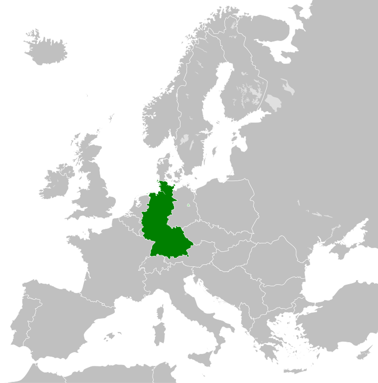
| 00:39, 26 çiriya paşîn 2011 |  | 450 x 456 (474 KB) | StalwartUK | == {{int:filedesc}} == {{Information |Description={{en|Map of West Germany (Federal Republic of Germany) as it was from 1949-1990. Surrounding countries accurate from 1956-1990.}} |Source=*[[:File:Blank_map_of_Europe_1956-1990.svg|Bla |
Bikaranîna pelê
Ev rûpelên li jêr vê dosyeyê bi kar tînin:
Bikaranîna gerdûnî ya pelê
Ev wîkiyên di rêzê de vê pelê bi kar tînin:
- Bikaranîna di af.wikipedia.org de
- Bikaranîna di an.wikipedia.org de
- Bikaranîna di ar.wikipedia.org de
- Bikaranîna di ast.wikipedia.org de
- Bikaranîna di be.wikipedia.org de
- Bikaranîna di bn.wikipedia.org de
- Bikaranîna di bs.wikipedia.org de
- Bikaranîna di ca.wikipedia.org de
- Bikaranîna di cs.wikipedia.org de
- Bikaranîna di da.wikipedia.org de
- Bikaranîna di el.wikipedia.org de
- Bikaranîna di en.wikipedia.org de
- Bikaranîna di eo.wikipedia.org de
- Bikaranîna di es.wikipedia.org de
- Bikaranîna di eu.wikipedia.org de
- Bikaranîna di fi.wikipedia.org de
- Bikaranîna di fr.wikipedia.org de
- Bikaranîna di fr.wiktionary.org de
- Bikaranîna di ga.wikipedia.org de
- Bikaranîna di gl.wikipedia.org de
- Bikaranîna di gv.wikipedia.org de
- Bikaranîna di ha.wikipedia.org de
- Bikaranîna di he.wikipedia.org de
- Bikaranîna di hi.wikipedia.org de
- Bikaranîna di hr.wikipedia.org de
- Bikaranîna di ia.wikipedia.org de
- Bikaranîna di id.wikipedia.org de
- Bikaranîna di io.wikipedia.org de
- Bikaranîna di it.wikipedia.org de
- Bikaranîna di ja.wikipedia.org de
- Bikaranîna di ka.wikipedia.org de
- Bikaranîna di ko.wikipedia.org de
- Bikaranîna di lij.wikipedia.org de
- Bikaranîna di lld.wikipedia.org de
- Bikaranîna di lmo.wikipedia.org de
- Bikaranîna di lt.wikipedia.org de
- Bikaranîna di lv.wikipedia.org de
- Bikaranîna di mk.wikipedia.org de
- Bikaranîna di ml.wikipedia.org de
- Bikaranîna di mr.wikipedia.org de
- Bikaranîna di ms.wikipedia.org de
- Bikaranîna di nl.wikipedia.org de
Zêdetir bikaranîna global a vê pelê bibîne.