
Wêne:A new map of Upper and Lower Canada from the latest authorities - 1811.jpg
Mezinahiya vê pêşdîtinê: 678 × 600 pîksel. Resolusyonên din: 271 × 240 pîksel | 543 × 480 pîksel | 868 × 768 pîksel | 1158 × 1024 pîksel | 2315 × 2048 pîksel | 3000 × 2654 pîksel.
Dosyeya orjînal (3000 × 2654 pixel, mezinbûnê data: 2,77 MB, MIME-typ: image/jpeg)
| Ev pel ji Wikimedia Commonsê ye. Agahdariya li ser rûpela danasîna pelê li jêr tê nîşandan. |
Danasîn
| Danasîn |
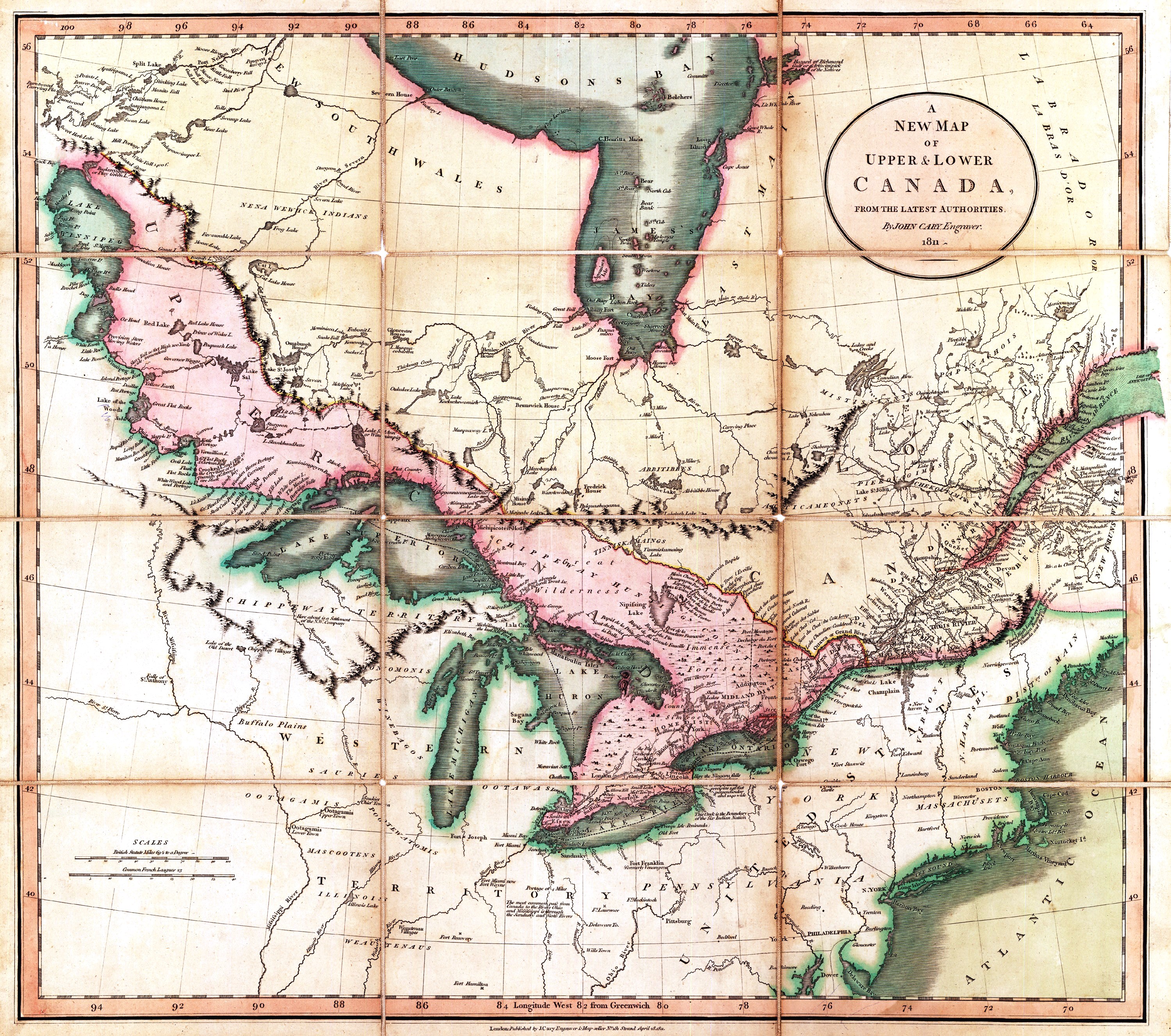
English: A New Map of Upper & Lower Canada, from the latest authorities |
| Dîrok | |
| Çavkanî | http://crccf.uottawa.ca/passeport/I/IA2a/IA2a01_bbb.html |
| Xwedî | John Cary |
Lîsans
|
This work is in the public domain in its country of origin and other countries and areas where the copyright term is the author's life plus 70 years or fewer. This work is in the public domain in the United States because it was published (or registered with the U.S. Copyright Office) before January 1, 1929. | |
| This file has been identified as being free of known restrictions under copyright law, including all related and neighboring rights. | |
Dîroka daneyê
Ji bo dîtina guhartoya wê demê bişkoka dîrokê bitikîne.
| Dîrok/Katjimêr | Wêneyê biçûk | Mezinahî | Bikarhêner | Şirove | |
|---|---|---|---|---|---|
| niha | 18:24, 23 îlon 2017 | | 3000 x 2654 (2,77 MB) | Jeangagnon | User created page with UploadWizard |
Bikaranîna pelê
Rûpelekî ku ji vê dosyeyê bi kar tîne nîne.
Bikaranîna gerdûnî ya pelê
Ev wîkiyên di rêzê de vê pelê bi kar tînin:
- Bikaranîna di de.wikipedia.org de
- Bikaranîna di en.wikipedia.org de
- Bikaranîna di id.wikipedia.org de