
Wêne:Great Britain 1789.svg

Size of this PNG preview of this SVG file: 450 × 456 pîksel. Resolusyonên din: 237 × 240 pîksel | 474 × 480 pîksel | 758 × 768 pîksel | 1011 × 1024 pîksel | 2021 × 2048 pîksel.
Dosyeya orjînal (Daneya SVG, mezinbûna rast: 450 × 456 pixel; mezinbûna daneyê: 848 KB)
| Ev pel ji Wikimedia Commonsê ye. Agahdariya li ser rûpela danasîna pelê li jêr tê nîşandan. |
Danasîn


.svg)
.svg)
.svg)
.svg)
.svg)


.svg)
.svg)
.svg)


.png)
.png)


.svg)


.svg)

.svg)


.svg)
.svg)
.svg)
.svg)


.svg)
.png)


.svg)


.svg)
.svg)


.svg)


.svg)


.svg)
.svg)
.svg)
.svg)
.svg)
.svg)
.svg)
_cropped.svg)
.svg)
.svg)
.svg)
.svg)
.svg)
.svg)
.svg)
.svg)
.svg)
.svg)
.svg)
.svg)
.svg)
.svg)
.svg)
.svg)
.svg)
.svg)
.svg)
.svg)
.svg)
.svg)
.svg)
.svg)
.svg)
.svg)
.svg)
.svg)
.svg)
.svg)
.svg)
.svg)
.svg)
.svg)
.svg)
.svg)
.svg)
.svg)
.svg)
.svg)
.svg)
.svg)
.svg)
.svg)
.svg)
Lîsans
I, the copyright holder of this work, hereby publish it under the following license:
Ev pel di bin lîsansa Creative Commons Attribution-Share Alike 3.0 Unported de lîsanskirî ye.
- Tu azad î:
- parve bike – ji bo kopîkirin, belavkirin û weşandina xebatê
- ji bo guhartin û adaptekirina naverokê – ji bo adaptekirina xebatê
- Di bin van mercan de:
- isnad – Divê tu isnadeke maqûl bikî, lînekek pêşkêş bikî ji bo lîsansê, û diyar bikî ku guhartin hatiye kirin an na. Tu dikarî vê yekê bi adilî bi cih bînî, lê ne bi awayê ku wekî lîsansor te an bikaranîna te pejirandibe.
- parvekirinê mîna hev – Ger tu materyalê biguherînî, bizivirînî formeke din, an ava bikî divê beşdariyên xwe di bin eynî lîsansê an lîsansa hevaheng de wekî ya eslî belav bikî.
Original upload log
This image is a derivative work of the following images:
- File:Europe_1789.svg licensed with Cc-by-sa-3.0
- 2013-04-14T03:44:26Z Alphathon 450x456 (858577 Bytes) Corrected some errors in northern Italy
- 2013-04-14T01:38:01Z Alphathon 450x456 (853881 Bytes) tweaked again
- 2013-04-14T01:36:10Z Alphathon 450x456 (853881 Bytes) Tweaked Holy Roman Empire border style
- 2013-04-14T01:33:26Z Alphathon 450x456 (853857 Bytes) == {{int:filedesc}} == {{Information |Description={{en|A blank Map of Europe circa 1789. This map also includes a border for the [[:en:Holy Roman Empire|Holy Roman Empire]]. Since there are so many small German states, they h
Uploaded with derivativeFX
Dîroka daneyê
Ji bo dîtina guhartoya wê demê bişkoka dîrokê bitikîne.
| Dîrok/Katjimêr | Wêneyê biçûk | Mezinahî | Bikarhêner | Şirove | |
|---|---|---|---|---|---|
| niha | 16:42, 19 kanûna pêşîn 2023 | | 450 x 456 (848 KB) | Iktsokh | Cyprus paler grey |
| 11:17, 26 gulan 2022 |  | 450 x 456 (846 KB) | Cyygma | Changing pale green to light green (more visible) | |
| 08:08, 17 çiriya pêşîn 2021 |  | 450 x 456 (846 KB) | Fenn-O-maniC | Fixed the Russo-Swedish border to match the Treaty of Åbo of 1743 | |
| 16:20, 5 îlon 2017 |  | 450 x 456 (857 KB) | Alphathon | Danzig | |
| 15:55, 5 îlon 2017 |  | 450 x 456 (840 KB) | Alphathon | Added Brunswick-Lüneburg to British domains as it was rules in a personal union | |
| 15:45, 5 îlon 2017 |  | 450 x 456 (840 KB) | Alphathon | Made Asia paler grey | |
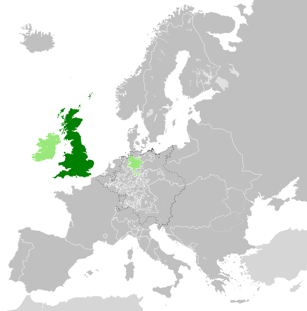
| 15:34, 5 îlon 2017 |  | 450 x 456 (840 KB) | Alphathon | == {{int:filedesc}} == {{Information |Description={{en|A map of the en:Kingdom of Great Britain circa 1789. Other British-held territories (Ireland, Mann, Channel Islands) are also shown in pale green.}}{{de|Eine Karte des [[:de:Königreich Groß... |
Bikaranîna pelê
Rûpelekî ku ji vê dosyeyê bi kar tîne nîne.
Bikaranîna gerdûnî ya pelê
Ev wîkiyên di rêzê de vê pelê bi kar tînin:
- Bikaranîna di azb.wikipedia.org de
- Bikaranîna di bn.wikipedia.org de
- Bikaranîna di cs.wikipedia.org de
- Bikaranîna di da.wikipedia.org de
- Bikaranîna di de.wikipedia.org de
- Bikaranîna di el.wikipedia.org de
- Bikaranîna di en.wikipedia.org de
- Bikaranîna di es.wikipedia.org de
- Bikaranîna di eu.wikipedia.org de
- Bikaranîna di fi.wikipedia.org de
- Bikaranîna di fr.wikipedia.org de
- Bikaranîna di fy.wikipedia.org de
- Bikaranîna di gv.wikipedia.org de
- Bikaranîna di he.wikipedia.org de
- Bikaranîna di id.wikipedia.org de
- Bikaranîna di it.wikipedia.org de
- Bikaranîna di ja.wikipedia.org de
- Bikaranîna di ko.wikipedia.org de
- Bikaranîna di lo.wikipedia.org de
- Bikaranîna di lv.wikipedia.org de
- Bikaranîna di pt.wikipedia.org de
- Bikaranîna di sco.wikipedia.org de
- Bikaranîna di sk.wikipedia.org de
- Bikaranîna di sl.wikipedia.org de
- Bikaranîna di sq.wikipedia.org de
- Bikaranîna di th.wikipedia.org de
- Bikaranîna di tr.wikipedia.org de
- Bikaranîna di vi.wikipedia.org de
- Bikaranîna di xmf.wikipedia.org de
- Bikaranîna di zh.wikipedia.org de