
Wêne:Nepaul valley map 1802.jpg
Dosyeya orjînal (3012 × 2916 pixel, mezinbûnê data: 2,2 MB, MIME-typ: image/jpeg)
| Ev pel ji Wikimedia Commonsê ye. Agahdariya li ser rûpela danasîna pelê li jêr tê nîşandan. |
Danasîn
| Danasîn |
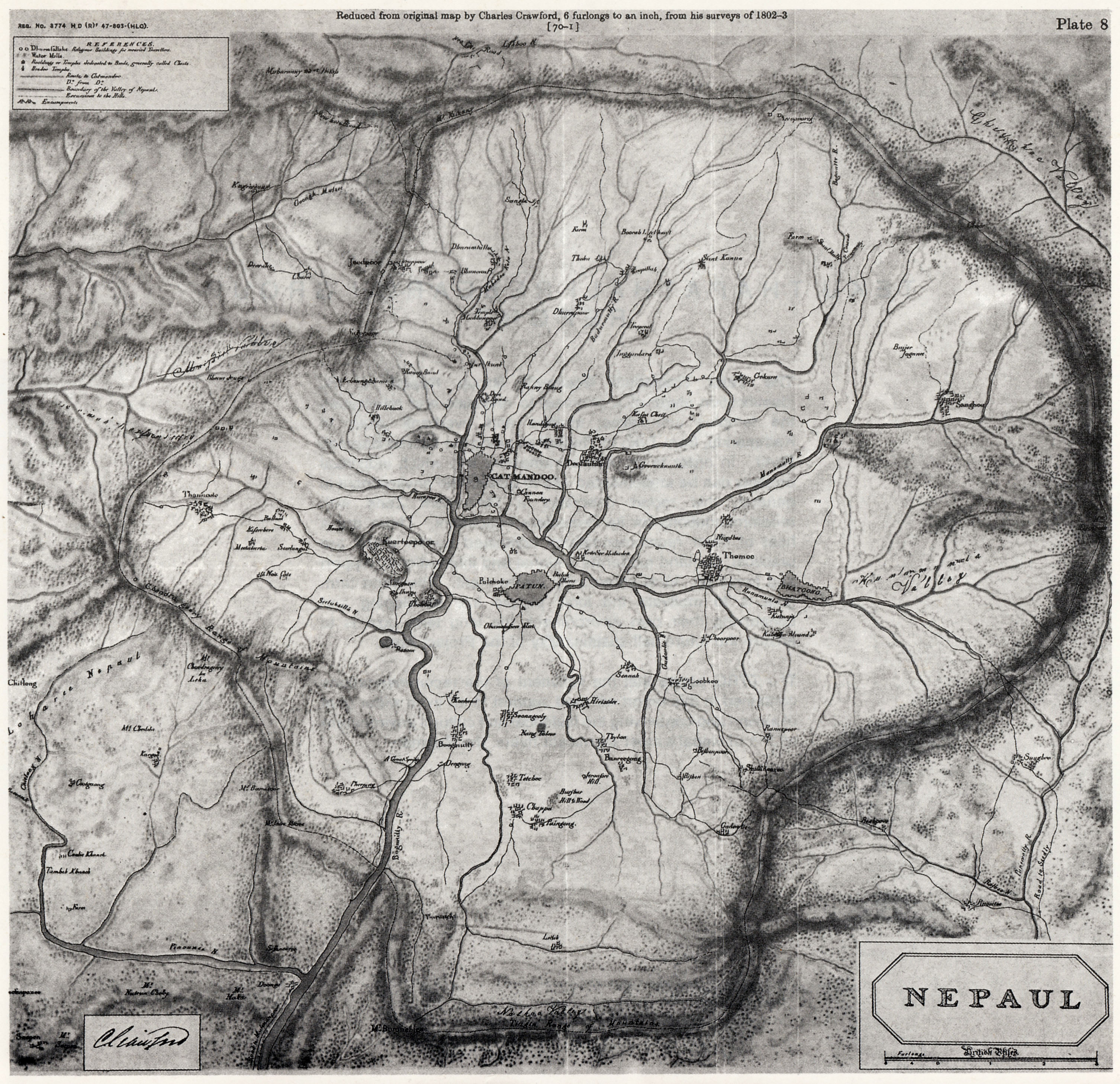
English: Scan of map of Nepaul, present-day Kathmandu Valley and surrounding areas in Nepal, made by Charles Crawford in 1802-03. |
| Dîrok | |
| Çavkanî | Min çêkir |
| Xwedî | Zulufive |
Lîsans
|
This work is in the public domain in its country of origin and other countries and areas where the copyright term is the author's life plus 70 years or fewer.
| |
| This file has been identified as being free of known restrictions under copyright law, including all related and neighboring rights. | |
Dîroka daneyê
Ji bo dîtina guhartoya wê demê bişkoka dîrokê bitikîne.
| Dîrok/Katjimêr | Wêneyê biçûk | Mezinahî | Bikarhêner | Şirove | |
|---|---|---|---|---|---|
| niha | 17:56, 13 çiriya paşîn 2012 | | 3012 x 2916 (2,2 MB) | Zulufive | User created page with UploadWizard |
Bikaranîna pelê
Rûpelekî ku ji vê dosyeyê bi kar tîne nîne.
Bikaranîna gerdûnî ya pelê
Ev wîkiyên di rêzê de vê pelê bi kar tînin:
- Bikaranîna di bn.wikipedia.org de
- Bikaranîna di cs.wikipedia.org de
- Bikaranîna di de.wikipedia.org de
- Bikaranîna di en.wikipedia.org de
- Bikaranîna di ka.wikipedia.org de
- Bikaranîna di min.wikipedia.org de
- Bikaranîna di mr.wikipedia.org de
- Bikaranîna di ne.wikipedia.org de
- Bikaranîna di sl.wikipedia.org de
- Bikaranîna di ta.wikipedia.org de