
Wêne:BlankMap-World-162E.svg

Dosyeya orjînal (Daneya SVG, mezinbûna rast: 3100 × 1600 pixel; mezinbûna daneyê: 1,35 MB)
| Ev pel ji Wikimedia Commonsê ye. Agahdariya li ser rûpela danasîna pelê li jêr tê nîşandan. |
| Danasîn |
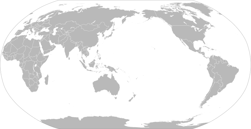
English: A political map of the world centered at the 162E longitude line.
Detailed SVG map with grouping enabled to connect all non-contiguous parts of a country's territory for easy colouring. Smaller countries can also be represented by larger circles to show their data easier. A thorough description of use and other instructions relating to can be found on the instruction page한국어: 동경 162도 경선을 중앙으로 한 빈 전세계지도입니다.
지형이 이어져 있지 않은 국가를 간단히 색깔을 입히기 위해 그룹이 지어진 자세한 SVG 지도 파일입니다. 작은 국가들은 더 큰 원으로 표시하여 데이터를 좀 더 간단히 나타낼 수 있습니다. 그림과 연관된 자세한 설명과 다른 지침들은 지침 문서 (영문)에서 확인하세요. |
||
| Dîrok | |||
| Çavkanî | Based on File:BlankMap-World.svg and rotated using the pythonscript available at http://gsl-nagoya-u.net/appendix/software/worldmap/ | ||
| Xwedî | Lokal_Profil | ||
| Destûr (Dîsa bikaranînê vê dosyeye) |
The map data manipulated by the script is in the public domain. The raw output of the script, including the file shown here, is also in the public domain.
|
||
| Guhartoyên din |
Derivative works of this file:
|
||
| SVG genesis |


_(162E).svg)
Dîroka daneyê
Ji bo dîtina guhartoya wê demê bişkoka dîrokê bitikîne.
| Dîrok/Katjimêr | Wêneyê biçûk | Mezinahî | Bikarhêner | Şirove | |
|---|---|---|---|---|---|
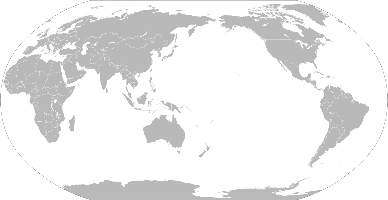
| niha | 20:15, 6 îlon 2021 | | 3100 x 1600 (1,35 MB) | Milenioscuro | thin border |
| 20:04, 6 îlon 2021 |  | 3100 x 1600 (1,35 MB) | Milenioscuro | fixed and cropped | |
| 12:48, 17 tîrmeh 2020 |  | 940 x 477 (2,9 MB) | Hogweard | Update format, and make South Sudan selectable | |
| 13:04, 25 sibat 2012 |  | 940 x 477 (3,53 MB) | Sammy pompon | Added South Sudan | |
| 13:01, 25 sibat 2012 |  | 940 x 477 (3,53 MB) | Sammy pompon | Added South Sudan | |
| 22:24, 13 nîsan 2008 |  | 940 x 477 (3,45 MB) | Lokal Profil | {{Information |Description=A blank map of the world centered at the 162E longitude line. Detailed SVG map with grouping enabled to connect all non-contiguous parts of a country's territory for easy colouring. Smaller countries can also be represented b |
Bikaranîna pelê
Rûpelekî ku ji vê dosyeyê bi kar tîne nîne.
Bikaranîna gerdûnî ya pelê
Ev wîkiyên di rêzê de vê pelê bi kar tînin:
- Bikaranîna di bn.wikipedia.org de
- Bikaranîna di cs.wikipedia.org de
- Bikaranîna di de.wikipedia.org de
- Bikaranîna di de.wikibooks.org de
- Bikaranîna di en.wikipedia.org de
- Bikaranîna di en.wikibooks.org de
- Bikaranîna di es.wikipedia.org de
- Bikaranîna di et.wikipedia.org de
- Bikaranîna di eu.wikipedia.org de
- Bikaranîna di fr.wikipedia.org de
- Bikaranîna di fr.wikiversity.org de
- Bikaranîna di ha.wikipedia.org de
- Bikaranîna di he.wikipedia.org de
- Bikaranîna di hy.wikipedia.org de
- Bikaranîna di ja.wikipedia.org de
- Bikaranîna di ko.wikipedia.org de
- Bikaranîna di lo.wikipedia.org de
- Bikaranîna di pnb.wikipedia.org de
- Bikaranîna di ru.wikipedia.org de
- Bikaranîna di th.wikipedia.org de
Zêdetir bikaranîna global a vê pelê bibîne.