
Wêne:Landappbw 933759 1817 Ehem. Klosterhof der Probstei Nellingen des Klosters St. Blasien Ostfildern-Nellingen.jpg

Mezinahiya vê pêşdîtinê: 800 × 533 pîksel. Resolusyonên din: 320 × 213 pîksel | 640 × 427 pîksel | 1024 × 683 pîksel | 1280 × 853 pîksel | 1620 × 1080 pîksel.
Dosyeya orjînal (1620 × 1080 pixel, mezinbûnê data: 330 KB, MIME-typ: image/jpeg)
| Ev pel ji Wikimedia Commonsê ye. Agahdariya li ser rûpela danasîna pelê li jêr tê nîşandan. |
Danasîn
| Danasîn |
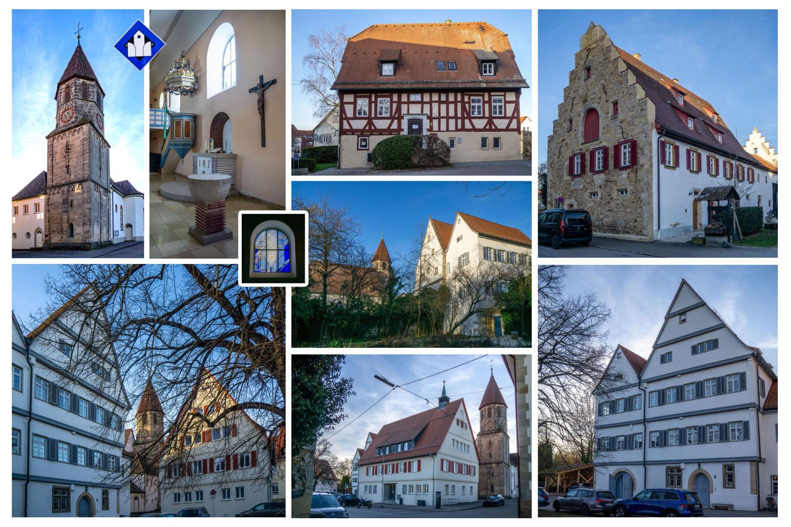
Deutsch: - Das alte Pfarrhaus (Klosterhof 4): Fachwerk-Wohnhaus (16. Jh.), Pfarrhaus bis 1838, heute Bildungs- und Kultureinrichtungen
- Die Ehem. Mesnerei und alten Schule (Klosterhof 6), 1826 durch einen Neubau ersetzt, mehrfach umgebaut, heute Verwaltung - Ev. Pfarrkirche (Klosterhof 8) [offene Kirche]: ehem. Probsteikirche St. Blasius, romanischer Turm (13. Jh.), 1926 Renovierung und Erweiterung - Rathaus (Klosterhof 10): 1954, an Stelle der ehem. Kellerei / württemb. Kanzlei (1649-1838), Rathaus seit 1844, heute Verwaltung - ehem. Probstei und Stabskellerei (ab 1649), seit 1836 Pfarrhaus (Klosterhof 12), heute Bürgermeisteramt - Fruchtkasten (Klosterhof 3) |
| Dîrok | 22 sibat 2024, 17:57:18 (original upload date) |
| Çavkanî | overview - direct - dataset |
| Xwedî | Willi Bautz |
| Destûr (Dîsa bikaranînê vê dosyeye) |
Creative Commons Zero (CC0) |
| ID | 933759 |
| Category | 1829 |
| Şûnda objeyê | | Ev wêne û yên din li ser OpenStreetMap |
|---|
This media file was collected by Landauf, LandApp under the ID 933759. This tag does not indicate the copyright status of the attached work. A normal copyright tag is still required. See Commons:Licensing. |
Lîsans
| This file is made available under the Creative Commons CC0 1.0 Universal Public Domain Dedication. | |
| The person who associated a work with this deed has dedicated the work to the public domain by waiving all of their rights to the work worldwide under copyright law, including all related and neighboring rights, to the extent allowed by law. You can copy, modify, distribute and perform the work, even for commercial purposes, all without asking permission.
|
Dîroka daneyê
Ji bo dîtina guhartoya wê demê bişkoka dîrokê bitikîne.
| Dîrok/Katjimêr | Wêneyê biçûk | Mezinahî | Bikarhêner | Şirove | |
|---|---|---|---|---|---|
| niha | 22:52, 23 sibat 2024 | | 1620 x 1080 (330 KB) | LaserlichtBot | =={{int:filedesc}}== {{Information |description={{de|1=- Das alte Pfarrhaus (Klosterhof 4): Fachwerk-Wohnhaus (16. Jh.), Pfarrhaus bis 1838, heute Bildungs- und Kultureinrichtungen - Die Ehem. Mesnerei und alten Schule (Klosterhof 6), 1826 durch einen Neubau ersetzt, mehrfach umgebaut, heute Verwaltung - Ev. Pfarrkirche (Klosterhof 8) [offene Kirche]: ehem. Probsteikirche St. Blasius, romanischer Turm (13. Jh.), 1926 Renovierung und Erweiterung - Rathaus (Klosterhof 10): 1954, an Stelle d... |
Bikaranîna pelê
Ev rûpelên li jêr vê dosyeyê bi kar tînin:
Bikaranîna gerdûnî ya pelê
Ev wîkiyên di rêzê de vê pelê bi kar tînin:
- Bikaranîna di ar.wikipedia.org de
- Bikaranîna di ce.wikipedia.org de
- Bikaranîna di de.wikivoyage.org de
- Bikaranîna di fr.wikipedia.org de
- Bikaranîna di fr.wikivoyage.org de
- Bikaranîna di hu.wikipedia.org de
- Bikaranîna di lld.wikipedia.org de
- Bikaranîna di lmo.wikipedia.org de
- Bikaranîna di mdf.wikipedia.org de
- Bikaranîna di pl.wikipedia.org de
- Bikaranîna di ro.wikipedia.org de
- Bikaranîna di ru.wikipedia.org de
- Bikaranîna di sr.wikipedia.org de
- Bikaranîna di tt.wikipedia.org de
- Bikaranîna di uz.wikipedia.org de
- Bikaranîna di vi.wikipedia.org de
- Bikaranîna di vo.wikipedia.org de
- Bikaranîna di www.wikidata.org de