
Wêne:Paris department land cover location map.svg

Size of this PNG preview of this SVG file: 800 × 521 pîksel. Resolusyonên din: 320 × 208 pîksel | 640 × 417 pîksel | 1024 × 667 pîksel | 1280 × 834 pîksel | 2560 × 1667 pîksel | 1371 × 893 pîksel.
Dosyeya orjînal (Daneya SVG, mezinbûna rast: 1371 × 893 pixel; mezinbûna daneyê: 6,75 MB)
| Ev pel ji Wikimedia Commonsê ye. Agahdariya li ser rûpela danasîna pelê li jêr tê nîşandan. |
Danasîn
| Sernav |
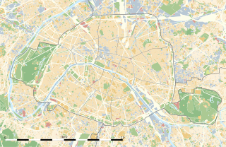
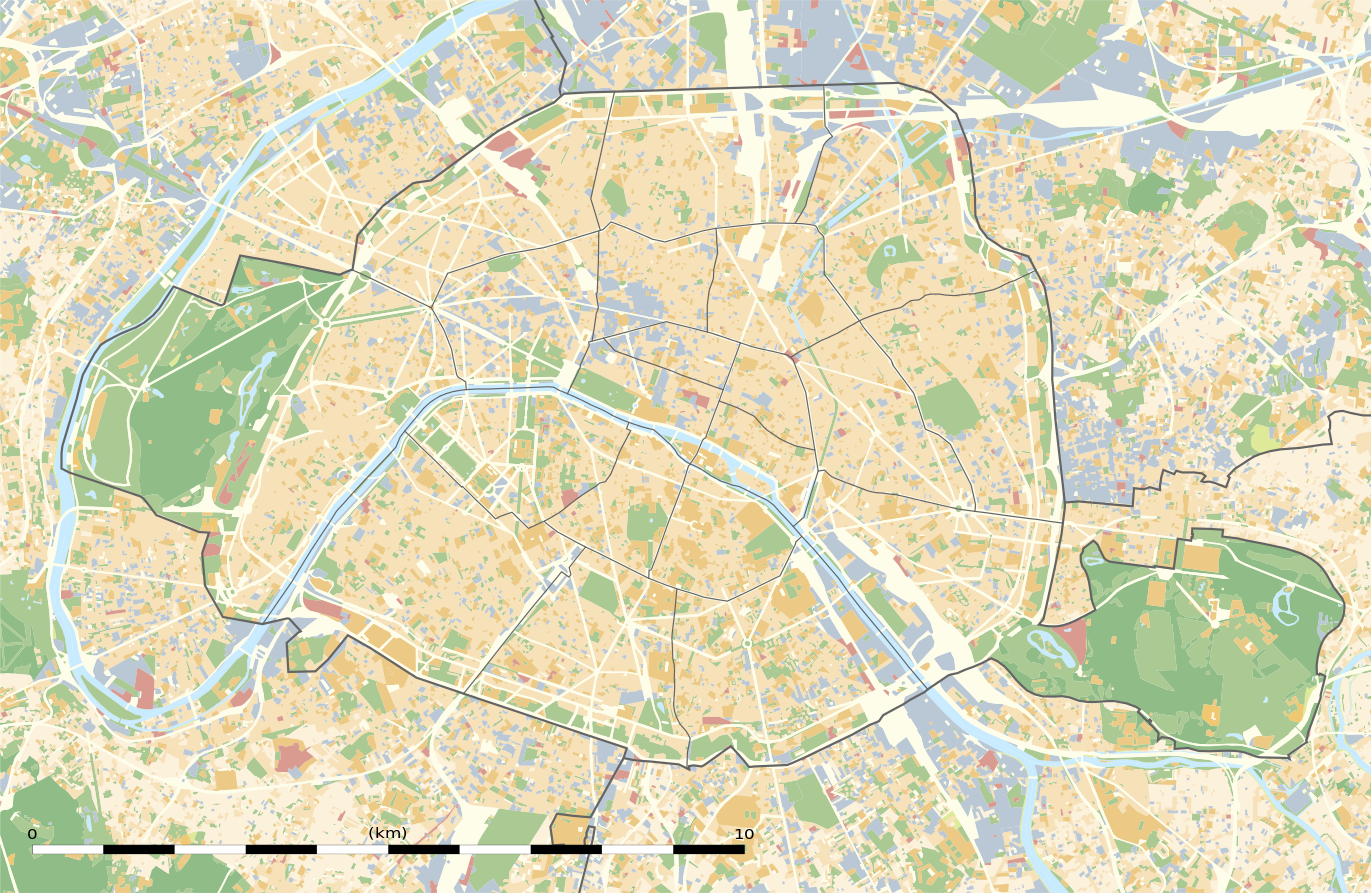
Blank land cover map of the city and department of Paris, France |
||||||||||||||||||||||||||||||||||||
| Description |
English: Blank land cover map of the city and department of Paris, France, as in January 2012, for geo-location purpose, with distinct boundaries for departments and arrondissements.
Français : Carte vierge de l'occupation du sol de la ville et département de Paris, France, tel qu'en janvier 2012, destinée à la géolocalisation, avec limite distincte des départements et arrondissements. |
||||||||||||||||||||||||||||||||||||
| Map legend |
|
||||||||||||||||||||||||||||||||||||
| Dîrok | |||||||||||||||||||||||||||||||||||||
| Çavkanî |
Min çêkir
|
||||||||||||||||||||||||||||||||||||
| Çêker | |||||||||||||||||||||||||||||||||||||
| Destûr (Dîsa bikaranînê vê dosyeye) |
|
||||||||||||||||||||||||||||||||||||
| Geotemporal data | |||||||||||||||||||||||||||||||||||||
| Date depicted | |||||||||||||||||||||||||||||||||||||
| Map location | Parîs 48°51′24″N 2°21′03″E / 48.8567°N 2.3508°E | ||||||||||||||||||||||||||||||||||||
| Spatial reference system | WGS84 datum | ||||||||||||||||||||||||||||||||||||
| Scale | 1:124,000 (precision: 31 m) | ||||||||||||||||||||||||||||||||||||
| Heading |
 |
||||||||||||||||||||||||||||||||||||
| Bounding box |
|
||||||||||||||||||||||||||||||||||||
| Georeferencing | If inappropriate please set warp_status = skip to hide. | ||||||||||||||||||||||||||||||||||||
| Guhartoyên din |
|
||||||||||||||||||||||||||||||||||||


Lîsans
Eric Gaba, Wikimedia Commons user Sting, the copyright holder of this work, hereby publishes it under the following license:
Ev pel di bin lîsansa Creative Commons Attribution-Share Alike 3.0 Unported de lîsanskirî ye.
Lê bar kirin: Eric Gaba, Wikimedia Commons user Sting
- Tu azad î:
- parve bike – ji bo kopîkirin, belavkirin û weşandina xebatê
- ji bo guhartin û adaptekirina naverokê – ji bo adaptekirina xebatê
- Di bin van mercan de:
- isnad – Divê tu isnadeke maqûl bikî, lînekek pêşkêş bikî ji bo lîsansê, û diyar bikî ku guhartin hatiye kirin an na. Tu dikarî vê yekê bi adilî bi cih bînî, lê ne bi awayê ku wekî lîsansor te an bikaranîna te pejirandibe.
- parvekirinê mîna hev – Ger tu materyalê biguherînî, bizivirînî formeke din, an ava bikî divê beşdariyên xwe di bin eynî lîsansê an lîsansa hevaheng de wekî ya eslî belav bikî.
Dîroka daneyê
Ji bo dîtina guhartoya wê demê bişkoka dîrokê bitikîne.
| Dîrok/Katjimêr | Wêneyê biçûk | Mezinahî | Bikarhêner | Şirove | |
|---|---|---|---|---|---|
| niha | 02:18, 12 sibat 2015 | | 1371 x 893 (6,75 MB) | Sting | == {{int:filedesc}} == {{Location|48|51|22.5|N|02|20|37.5|E|scale:50000}} {{Information |Description={{en|Blank land cover map of the city and department of Paris, France, as in January 2012, for geo-location purpose, with distinct bounda... |
Bikaranîna pelê
Ev 5 rûpel li jêr vê dosyeyê bi kar tînin:
Bikaranîna gerdûnî ya pelê
Ev wîkiyên di rêzê de vê pelê bi kar tînin:
- Bikaranîna di als.wikipedia.org de
- Bikaranîna di ar.wikipedia.org de
- Bikaranîna di ast.wikipedia.org de
- Bikaranîna di azb.wikipedia.org de
- Bikaranîna di az.wikipedia.org de
- Bikaranîna di be.wikipedia.org de
- Bikaranîna di bg.wikipedia.org de
- Бастилия
- Отьой
- Дефанс
- Пер Лашез
- Халите (Париж)
- Музей Орсе
- Монмартър
- Университет „Париж-VI: Пиер и Мария Кюри“
- Университет Париж-I Пантеон-Сорбона
- Университет Париж-VII: Дени Дидро
- Университет Пари-Дофин
- Национална библиотека на Франция
- Александър III (мост)
- Ил дьо ла Сите
- Монпарнас
- Маре (Париж)
- Жусийо (кампус)
- Музей на изкуството и историята на юдаизма
- Шаблон:ПК Франция Париж
Zêdetir bikaranîna global a vê pelê bibîne.