
Wêne:British Isles England.svg

Size of this PNG preview of this SVG file: 343 × 600 pîksel. Resolusyonên din: 137 × 240 pîksel | 274 × 480 pîksel | 439 × 768 pîksel | 586 × 1024 pîksel | 1171 × 2048 pîksel | 675 × 1180 pîksel.
Dosyeya orjînal (Daneya SVG, mezinbûna rast: 675 × 1180 pixel; mezinbûna daneyê: 150 KB)
| Ev pel ji Wikimedia Commonsê ye. Agahdariya li ser rûpela danasîna pelê li jêr tê nîşandan. |
Danasîn
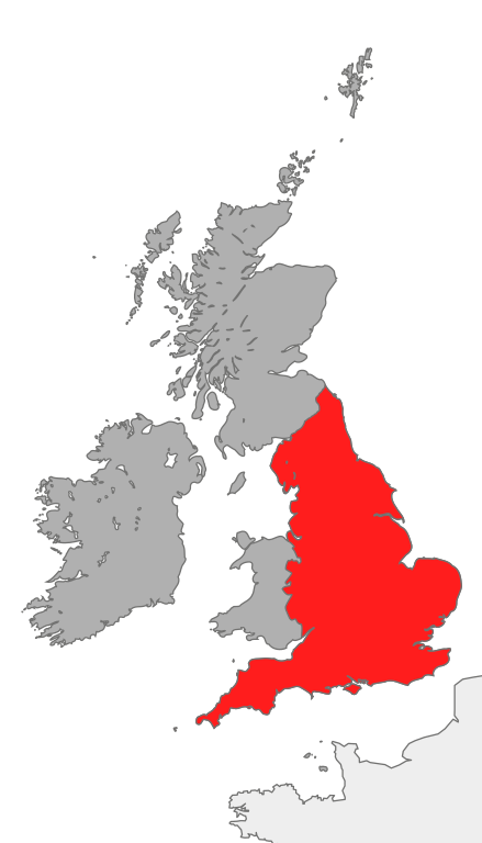
| Danasîn | map showing the area of England in relation to Great Britain and Ireland |
| Dîrok | |
| Çavkanî | Min çêkir |
| Xwedî | Cnbrb |
| SVG genesis |
Lîsans
| I, the copyright holder of this work, release this work into the public domain. This applies worldwide. In some countries this may not be legally possible; if so: I grant anyone the right to use this work for any purpose, without any conditions, unless such conditions are required by law. |
Dîroka daneyê
Ji bo dîtina guhartoya wê demê bişkoka dîrokê bitikîne.
| Dîrok/Katjimêr | Wêneyê biçûk | Mezinahî | Bikarhêner | Şirove | |
|---|---|---|---|---|---|
| niha | 18:39, 20 çiriya pêşîn 2007 | | 675 x 1180 (150 KB) | Cnbrb | == Summary == {{Information |Description=map showing the area of England in relation to Great Britain and Ireland |Source=self-made |Date=2007-20-09 |Author= Cnbrb }} Category:Locator maps of countries of the United Kingdom [[Category: |
Bikaranîna pelê
Ev rûpelên li jêr vê dosyeyê bi kar tînin:
Bikaranîna gerdûnî ya pelê
Ev wîkiyên di rêzê de vê pelê bi kar tînin:
- Bikaranîna di ar.wikipedia.org de
- Bikaranîna di ast.wiktionary.org de
- Bikaranîna di cs.wikipedia.org de
- Bikaranîna di en.wikipedia.org de
- Bikaranîna di es.wikipedia.org de
- Bikaranîna di fr.wikipedia.org de
- Bikaranîna di hr.wiktionary.org de
- Bikaranîna di hu.wikipedia.org de
- Bikaranîna di id.wikipedia.org de
- Bikaranîna di it.wikipedia.org de
- Bikaranîna di kaa.wikipedia.org de
- Bikaranîna di ro.wikipedia.org de
- Bikaranîna di ru.wikipedia.org de
- Bikaranîna di ss.wikipedia.org de
- Bikaranîna di tr.wikipedia.org de
- Bikaranîna di uk.wikipedia.org de
- Bikaranîna di vi.wikipedia.org de
- Bikaranîna di zh.wikipedia.org de